Base Torres Hike: The Trail to Mirador Las Torres, Section by Section
Twenty-one kilometres, 1,041 metres of ascent and a final 45 minutes on loose moraine. What the Base Torres trail actually asks of you, section by section.
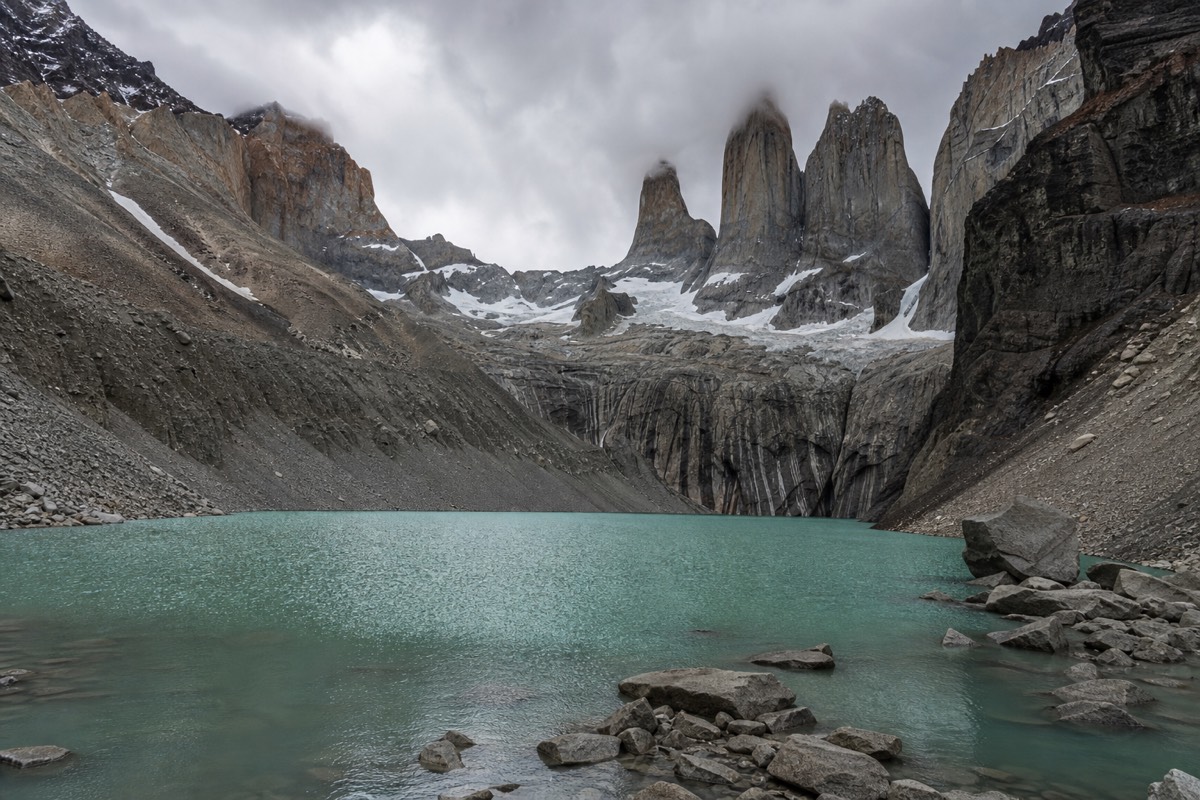
The last 800 metres of this trail climb about 200 metres over loose moraine, and they take most people 45 minutes. Everything anyone tells you about the Base Torres hike is really about those 45 minutes.
The rest of the day is long rather than technical: roughly 21 kilometres round trip from the Welcome Center with 1,041 metres of ascent, eight to ten hours of walking, and a trail that changes character three times before it hands you the towers. Below is what each of those sections actually asks of you, what the published numbers do and do not agree on, and why some very fit people have a worse day here than they expected.
The Base Torres climb against the park's other ascents
No source we could verify splits the Base Torres ascent by section beyond the final moraine, so the moraine is shown alongside the park's other climbs rather than as a share of the whole.
What is the most famous hike in Torres del Paine?
The Base Torres trail to Mirador Las Torres, the glacial lagoon directly beneath the three granite towers the park is named after. It is 21 kilometres round trip from the Welcome Center with 1,041 metres of ascent, takes eight to ten hours, and is the one walk that visitors who do nothing else in the park still do.
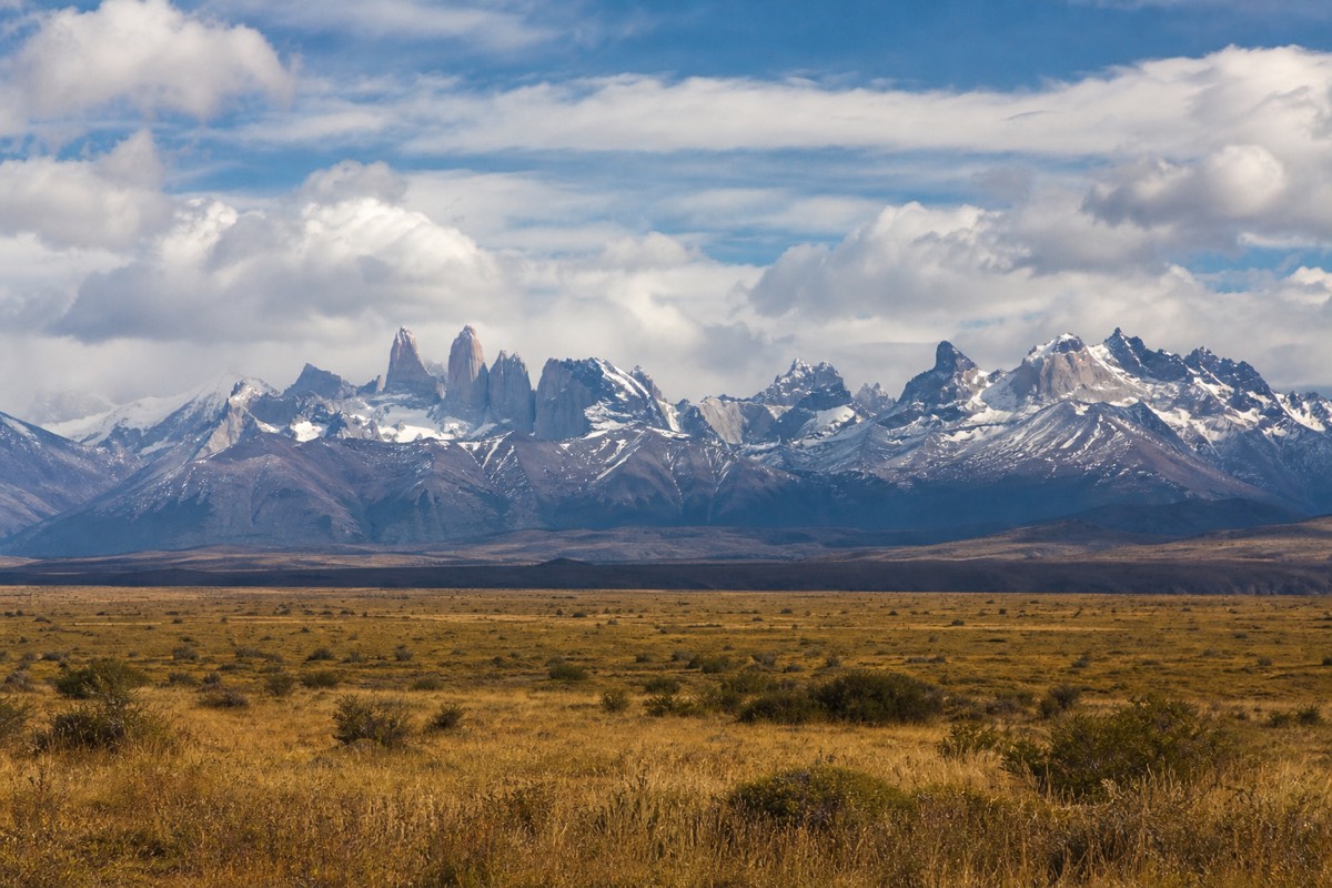
Its fame is partly geography. The towers are visible from the road on the eastern side, from Laguna Amarga, and from half the postcards in Puerto Natales, but the view from directly underneath them across the lagoon is a different thing entirely, and there is no shortcut to it. No road goes there, no boat, no lift. You walk.
It is also the final act of most W treks. The standard west to east direction puts the catamaran and Grey Glacier first and saves this trail for the last morning, usually at sunrise, which is why so many photographs of the towers are taken in the same twenty minute window of pink light. If you are building a longer trip, how the W trek is structured explains where this day falls.
The park has roughly 130 kilometres of marked trail and 367,426 people came through in 2024, concentrated heavily in January and February. A large share of them walk this one path. That is the trade: the best view in the park, shared with everyone who had the same idea.
Set against the park's other marked walks, the scale of it is obvious. Nothing else that can be done in a day comes close on either distance or climbing, and most of the alternatives are afternoon strolls by comparison.
| Walk | Distance | Ascent | Time |
|---|---|---|---|
| Base Torres to Mirador Las Torres | 21 km round trip | 1,041 m | 8 to 10 hours |
| Pingo valley | 21 km out and back | 750 m | 6 hours |
| Laguna Azul area walk | 19.4 km out and back | 470 m | 5 hours |
| Ferrier lookout from Lago Grey | 4 km out and back | 300 m | 2 hours |
| Mirador Cuernos from Salto Grande | 4 km out and back | 150 m | 1.5 hours |
| Mirador Condor near Pudeto | 3 km out and back | 200 m | 1.5 hours |
| Salto Grande from Pudeto | 1.5 km out and back | 20 m | 30 minutes |
How difficult is the Torres del Paine hike?
Hard, and consistently rated hard, but not technical. There is no scrambling, no exposure and no equipment beyond boots and poles. The difficulty is 1,041 metres of ascent spread across a long day, followed by a final steep section on loose rock, and then the same distance back down on tired legs.
Most people underestimate the descent. The climb is where the effort is, but the return leg is where knees and ankles fail, and it comes at hour six or seven when concentration has gone. The guided Base Torres day trip includes Black Diamond trekking poles for exactly this reason, and they are not a courtesy item.
Weather multiplies everything. The same trail in still, dry conditions and in a 60 to 100 kilometre per hour gust with rain is not the same walk, and the wind here almost always builds through the afternoon. Summer averages at Puerto Natales sit around 31 to 34 kilometres per hour, with November the windiest month at about 37, and the park itself is windier than the town. Regional sources have reported gusts up to about 193 kilometres per hour, which is an extreme rather than a normal, but it tells you what the trail can occasionally do.
A shorter answer to the same question lives at a quicker read on the difficulty. The honest summary is that a regular walker who does hills at home will finish it tired; a person who does not walk much at home will have a very long day.
How far is the Base Torres hike, and why do two published figures disagree?
You will see 21 kilometres with 1,041 metres of ascent, and you will see 20 kilometres with 870 metres. Both are in circulation, the second is what the guided day trip listing quotes, and the gap comes from where the measurement starts and which of the parallel tracks near Chileno is counted. Plan for the larger figure.
The variation is not sloppiness. The Welcome Center, Hotel Las Torres and the various car parks sit at slightly different points, and there is more than one line up the valley to the same place. Different mapping tools also record ascent differently on a trail that undulates as much as this one does, so cumulative gain and net gain diverge.
What matters is that the difference is not large enough to change your day. Whether it is 20 or 21 kilometres, whether it is 870 or 1,041 metres, you are out for eight to ten hours and the last section is the same. Where the figures do matter is when you compare listings and wonder why one operator's trip sounds easier than another's. It is not, they are quoting different sources.
| Measurement | Distance | Ascent | Typical time |
|---|---|---|---|
| Welcome Center to Mirador Las Torres, round trip, commonly published | 21 km | 1,041 m | 8 to 10 hours |
| The same walk as quoted on the guided day trip listing | 20 km, given as 12.43 miles | 870 m | 10 to 12 hours door to door from town |
| From Refugio Chileno to the mirador, round trip | 8 to 10 km | not consistently published | about 4 hours |
| The final moraine section, one way | 0.8 km | about 200 m | 45 minutes |
The three sections of the trail, and what each one asks of you
The valley climb, the forest, and the moraine. The first is exposed and windy and does most of the early height gain. The second is sheltered lenga forest along the Ascencio river, past Refugio Chileno, and is the easiest walking of the day. The third is 0.8 kilometres of loose boulders that gains about 200 metres.
Section one: out of the valley floor
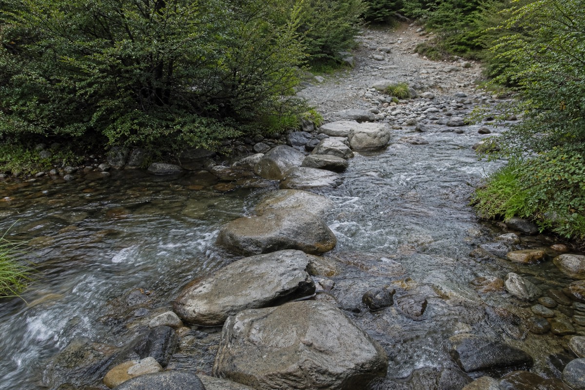
From the Welcome Center the trail crosses open ground and then climbs the flank of the valley on a well-made but relentless path. There is no shade and no shelter, which is why this is the part that feels worst in wind and the part people photograph least. It is also where an over-fast start does the most damage, because the gradient is steady enough that you can hold an unsustainable pace for half an hour without noticing.
Section two: the lenga forest along the Ascencio
The trail drops into the trees and follows the river, and the temperature changes immediately. Refugio Chileno sits in this stretch and is the only place on the route to buy food or use a toilet, which makes it the natural break whether or not you are sleeping there. Beyond Chileno the forest continues to Campamento Torres, gently enough that people underestimate how much height they are still gaining.
Section three: the moraine
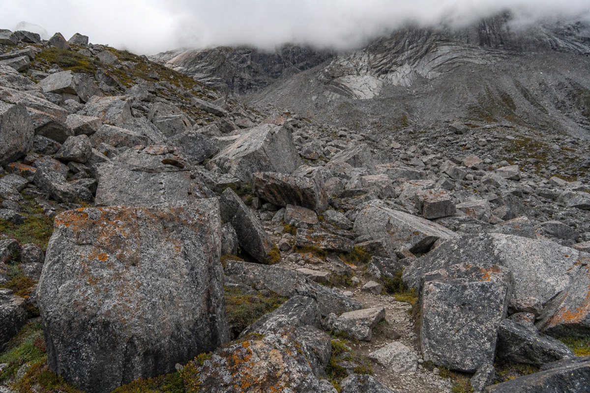
The trees stop and the boulders start, abruptly. This is the section covered below in detail, and it is the reason the whole trail is rated hard rather than moderate.
None of the three sections has a separately published ascent figure we can verify beyond the moraine's 200 metres, so treat the split above as a description of the ground rather than a set of numbers. If you want to see how this compares with the park's gentler options, the park's other day walks lists what else can be done in a morning.
Recommended tours by season
Torres del Paine Base Torres Trekking Day Trip from Puerto Natales
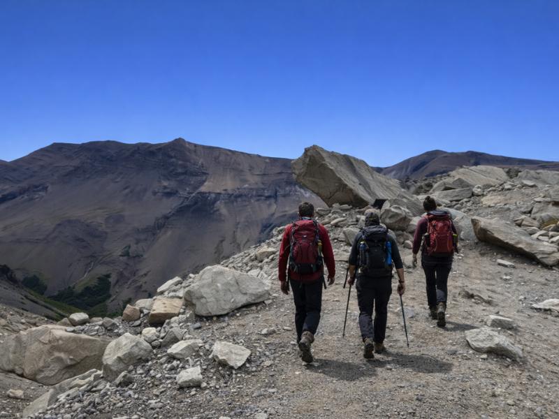
Year-round, including the winter guided-only dates: the whole trail from Puerto Natales in a single day, poles included, and crampons when there is ice.
Torres del Paine 2-Day Express Tour – Aventura & Highlights
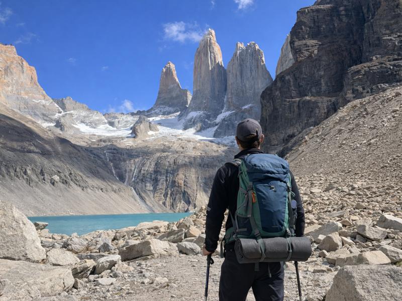
Shorter daylight: a roughly 22 km day to the viewpoint, then a night in an equipped tent at Pehoé camping, so the walk does not share the morning with the drive from town.
Torres del Paine W Trek Alternative 3-Day Guided Tour
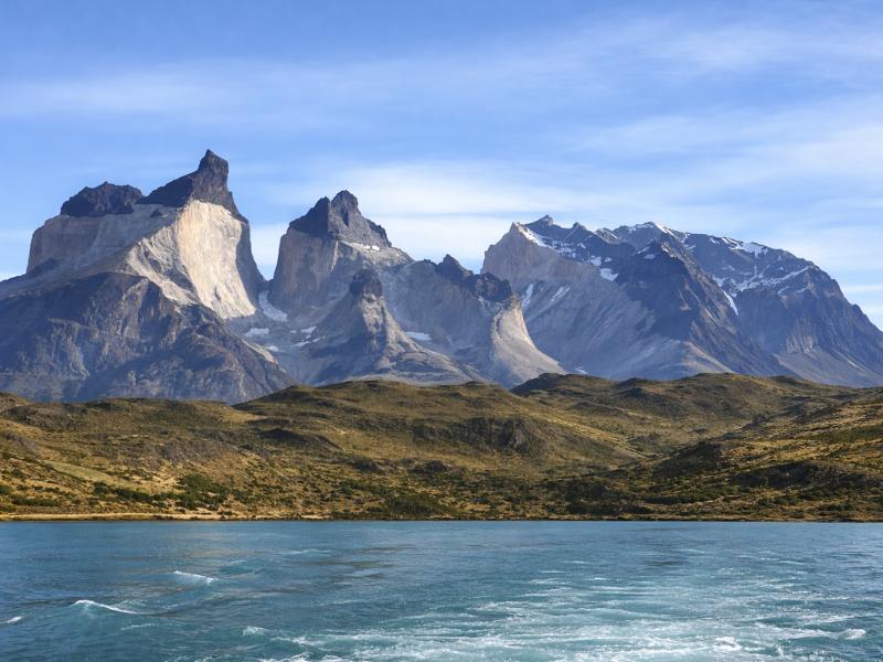
A three-day itinerary that links this trail with the French Valley and the Grey Glacier viewpoint from a fixed base, so the effort is spread across three days.
5-Day Torres del Paine W Trek – Guided Patagonia Adventure
This trail as part of a supported W trek, walked self-guided with beds, meals and transfers arranged, listed as 19.5 km round trip. Not a fit for the winter guided-only window.
The moraine: the last 45 minutes
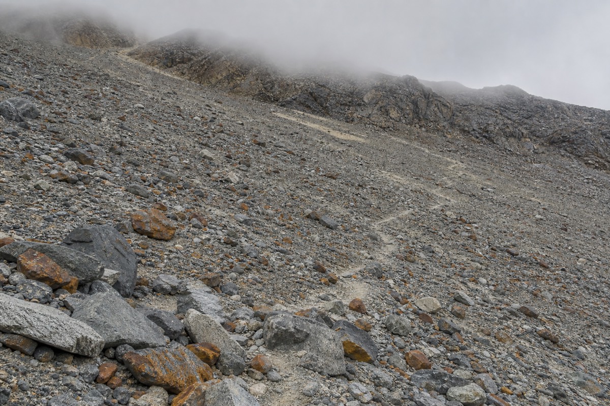
0.8 kilometres, about 200 metres of climbing, and roughly 45 minutes on a slope of loose glacial debris with no defined single path. It is the steepest ground on the trail by a wide margin, it is graded hard on its own, and it comes after five or six hours of walking. Then you arrive, and the lagoon is there.
The moraine is what a retreating glacier left behind: rock of every size, unconsolidated, with a route marked by posts and cairns rather than a built path. In dry conditions it is simply hard work. Wet, it is slippery. Under snow it needs crampons, which is why the guided trips carry them whenever there is ice on the ground rather than only in winter.
Two pieces of advice hold up here. Take it in short blocks with brief stops rather than trying to hold a rhythm, because there is no rhythm to hold on this surface. And keep something in reserve for the descent of it, which is genuinely harder than the ascent and is where most of the day's minor injuries happen.
At the top the trail ends at the lagoon beneath the three towers, and there is nowhere further to go. Most people give it 30 to 45 minutes. In wind that is optimistic; the lagoon sits in a bowl that funnels it, and there is little shelter unless you drop back down a little way and eat among the boulders.
How does the day break down, hour by hour?
On the guided day trip from town, pickup is between 06:30 and 07:00, the drive to the Porteria Amarga sector takes about two hours, the walk runs eight to ten hours, and you are back in Puerto Natales between 20:00 and 21:00. That is 13 to 14 hours door to door for eight to ten hours of walking.
Doing it independently from a bed inside the park shortens the day at both ends but adds the cost of staying inside the park. Doing it independently from town on public buses is the hardest version, because the timetable, not your legs, decides when you have to turn around.
The park gates run 07:00 to 21:00 from October to April and 08:00 to 18:30 from May to September, and the daylight varies enormously: late December gives roughly 05:00 to 22:00 in Puerto Natales, late June roughly 09:30 to 17:30. In December you have light to spare. In April you do not.
| Time | What is happening |
|---|---|
| 06:30 to 07:00 | pickup from Puerto Natales lodging |
| about 2 hours | drive to the Porteria Amarga sector |
| on arrival | park entry check, trail registration at the control point |
| 7 km transfer | shuttle from Laguna Amarga to the Welcome Center, 4,000 to 4,500 CLP, cash only |
| 8 to 10 hours | the walk itself, including 45 minutes on the moraine each way |
| 20:00 to 21:00 | back in Puerto Natales |
Is the sunrise start worth it?
Only if you are already sleeping inside the park. Sunrise at the mirador means walking most of the trail in the dark, which is realistic from Chileno or Central and not realistic from Puerto Natales, where the earliest pickups are 06:30. In late December the sun is up around 05:00, so a sunrise arrival means starting around 02:00.
The reward is real. The towers face east and catch the first light directly, which is why almost every well-known photograph of them was taken within half an hour of sunrise. It is also the calmest part of the day, before the wind builds, which matters as much for standing still at the lagoon as it does for the walking.
The risk is equally real. You commit to a 02:00 alarm and a headtorch descent of the moraine in the dark, and cloud can take the whole thing away with no warning and no second attempt. Plenty of people who go up in daylight and stay two hours see the towers better than the sunrise party who arrived into a whiteout. If photography is the point of the trip, shooting the towers at first light goes further into the timings.
The two-day express trip and the three-day guided trip solve this by putting you inside the park overnight, which is the honest way to get an early start without a 02:00 start from town.
Walking it from Chileno instead of the Welcome Center
From Refugio Chileno the round trip to the mirador is 8 to 10 kilometres and takes about four hours, against 21 kilometres and eight to ten hours from the Welcome Center. Sleeping at Chileno roughly halves the day. It is also the single hardest bed to get in the park, and it sells out first every season.
The maths is obvious enough that everyone does it, which is the problem. Chileno is operated by Las Torres Patagonia, the calendar for the next season opens around April, and the December and January dates go almost immediately. If Chileno is full, Central down at the trailhead is the fallback, and it removes the two hour drive but not much of the walking.
There is a cost angle too. Equipped camping in the Las Torres sectors is published in the $30 to $50 range for standard sites, with Serón running $40 to $90 in high season, and refugio beds elsewhere in the park are published between $46 and $114 per person. A night at Chileno to shorten one hike is a real expense, not a rounding error. How the two booking systems differ is set out in where the beds in the park are booked, and reservations go through Las Torres Patagonia directly.
| Starting point | Round trip | Time | What it costs you |
|---|---|---|---|
| Welcome Center, day trip from town | 21 km | 8 to 10 hours walking, 13 to 14 door to door | from $99 on the guided day trip |
| Central sector, sleeping at the trailhead | 21 km | 8 to 10 hours | equipped camping $30 to $50, beds higher |
| Refugio Chileno | 8 to 10 km | about 4 hours | sells out first every season |
Getting to the trailhead, and the 7 kilometres nobody budgets for
Buses from Puerto Natales reach Laguna Amarga in two to three hours over 112 kilometres, for roughly $20 to $29 one way. They do not reach the trailhead. A separate shuttle covers the last 7 kilometres to the Welcome Center for 4,000 to 4,500 Chilean pesos, cash only, and it is the connection people most often fail to plan for.
High season departures from the Terminal Rodoviario in Puerto Natales are commonly around 06:45, 07:00, 12:00 and 14:30, stopping at Laguna Amarga, Pudeto and Administración. Only the early ones give you enough day for this trail. There is no Uber in Puerto Natales and private transfers run around $150, so the bus and the shuttle are the realistic combination for independent walkers.
Bring cash in pesos for the shuttle. It is a small amount and a completely avoidable problem, and it happens to somebody in almost every busload. The wider transport picture, including what the buses do at each stop, is in the road from Puerto Natales to the park.
You also need a park ticket bought in advance. A foreign adult pays 34,000 pesos for a single day or 48,500 for the multi-day pass valid up to ten consecutive days, children under 12 are free, and tickets come from the official park ticketing portal. They are date-locked and non-refundable, and the payment totems at the gates exist mainly for private vehicles, so arriving on a bus without a QR code is a problem rather than a plan. Current figures and the exemptions are in what park entry costs now.
What does the cloud do to the view at the mirador?
It can remove it completely. The towers stand roughly a kilometre above the lagoon and are frequently in cloud when the valley below is clear. There is no forecast reliable enough to promise otherwise, and the standard local description of frontal systems crossing the massif, four seasons in one day, is a plain description rather than marketing.
Two things work in your favour. The eastern side of the park, where this trail is, is significantly drier than the western side around Grey, so the Grey sector can be raining while Laguna Amarga is dry. And cloud here moves fast: a viewpoint that is white on arrival is often open twenty minutes later, which is the argument for taking food up and waiting rather than turning straight round.
Rain days are common in every month. Puerto Natales records 11 to 16 wet days a month year round, with December and January the wettest at 155 and 147 millimetres, and the park is wetter than the town. September is the driest month on record, at 103 millimetres, though it is also cold and short on daylight. The Puerto Natales climate normals are the baseline these figures come from, and the park's weather month by month breaks them down against what each month means on the trail.
| Month | Avg high | Wet days | Avg wind | Daylight |
|---|---|---|---|---|
| October | 8.2 C | 14 | 33 kph | 13.5 h |
| November | 9.9 C | 15 | 37 kph | 15.5 h |
| December | 11.5 C | 16 | 34 kph | 17.0 h |
| January | 12.6 C | 16 | 32 kph | 16.5 h |
| February | 13.1 C | 13 | 31 kph | 15.0 h |
| March | 11.4 C | 15 | 30 kph | 13.0 h |
| April | 8.4 C | 14 | 29 kph | 11.0 h |
Winter, and the guided-only rule from 27 April to 30 August 2026
Between 27 April and 30 August 2026 the Base Torres trail may only be walked with an authorised guide. That is a park rule, not an operator preference, and it applies whether or not you have walked in snow before. Outside those dates the trail is open to independent walkers.
The reasoning is on the ground. Snow at trail level is likely from June to August, the moraine under snow needs crampons, and the daylight window in late June runs roughly 09:30 to 17:30, which is tight for an eight to ten hour walk. Gate hours also shorten to 08:00 to 18:30 in the low season. The rule takes the decision out of the hands of people who would otherwise get it wrong.
Winter has genuine advantages if you accept the constraint. The park is quiet, the light is low all day, and the guided trips run smaller: the Base Torres day trip from Puerto Natales works at a 1:6 guide ratio in summer and 1:4 in winter, and includes crampons when there is ice or snow. What it does not include is a headlamp, gaiters or personal mountain footwear, which are on you.
Current closures and access rules are published by CONAF, the park authority, and they change with conditions rather than with the calendar. Check before you commit to dates near either end of that window.
| Winter factor | What applies |
|---|---|
| Guided-only rule on this trail | 27 April to 30 August 2026, authorised guide required |
| Park gate hours, May to September | 08:00 to 18:30 |
| Daylight in late June | roughly 09:30 to 17:30 |
| Snow at trail level | likely June to August, possible at altitude in any month |
| Guide ratio on the day trip | 1:4 in winter against 1:6 in summer |
| Carried for you in winter | trekking poles, crampons when there is ice or snow |
| Still your responsibility | headlamp, gaiters, personal mountain footwear |
Who finds this harder than they expected?
Runners and gym-fit travellers with no hill days behind them, people who start too fast on the exposed first climb, anyone who skips poles, and anyone treating the descent as a formality. The trail does not punish a lack of fitness so much as a lack of pacing across a very long day. If this is your first attempt at a full day of trekking anywhere, whether Patagonia is a reasonable place to start is worth reading before you book it, and anyone weighing this single day against a full multi-day trek should check how much fitter the W trek demands you be.
The other group is people who arrive with the wrong mental model. Ten to twelve hours door to door from Puerto Natales is a full working day plus a commute, at the end of which you eat dinner at 21:00. Booked back to back with another activity the following morning, it is the reason people describe the trail as brutal when what was brutal was the schedule around it.
The honest fixes are dull. Break the day up, eat before you are hungry, use the poles that come with the guided Base Torres day trip, currently $99 with a bilingual guide and an assistant guide at a 1:6 ratio, and start early enough that the moraine happens before the wind. If you would rather sleep inside the park and walk it fresh, the two-day express trip at $620 puts a roughly 22 kilometre day to the viewpoint first and a night in a tent at Pehoé camping after it.
And if this trail is one part of a longer plan, the three-day guided trip at $1,175 links it with the French Valley and the Grey Glacier viewpoint from a fixed base, which spreads the effort over three days instead of stacking it into one. The rest of what we run is on the guided trips into the park we list, and the middle arm of the W is covered in the French Valley day explained. What to carry is in the day pack list for this trail.
Four of the trips we list put you on this trail, and they differ mainly in how much of the day they take off you. The prices below are current rather than permanent, so check the live listing before you plan a budget around them.
| Trip | From price | How it handles this trail |
|---|---|---|
| Guided Base Torres day trip | $99 | the whole trail in a day from Puerto Natales, poles included, crampons when there is ice |
| 2-day express trip | $620 | roughly 22 km to the viewpoint on day one, then a night in an equipped tent at Pehoé camping |
| Guided 3-day trip | $1,175 | this trail plus the French Valley and the Grey Glacier viewpoint from a fixed base camp |
| Supported 5-day W | $1,905 | listed as 19.5 km round trip, walked self-guided with beds, meals and transfers arranged |